
· Goher K · Mountaineering · 18 min read
Minglik Sar 6,050m Expedition: Shimshal Pass Karakoram Alpine Ascent
Complete climbing guide to Minglik Sar (6,050m). Master the rugged Shimshal Pass traverse, high acclimatization cycles, Wakhi camps, and Karakoram peak routes.
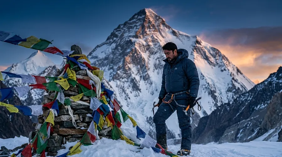
Minglik Sar (6,050m / 19,849ft) is a prominent glaciated trekking peak towering above the historic Shimshal Pass (approx. 4,700m) in the Karakoram Range of Hunza, Gilgit-Baltistan, Pakistan. Celebrated for its sweeping panoramic views of K2, Distaghil Sar, and Shimshal Whitehorn, Minglik Sar is widely regarded as one of Pakistan's finest introductory 6,000-meter alpine peaks. Reached via the notoriously demanding Shimshal Pass gorge traverse—renowned as the toughest pass trek in Pakistan due to sheer cliff tracks and massive daily elevation shifts—the standard route follows a non-technical 25- to 45-degree snow-and-glacier line. This expedition chronicle documents Goher K's independent alpine ascent, daily stage route maps, high-camp tactics, sub-zero conditions, and community contributions along the Wakhi shepherd trails.
The Long Walk to the Roof of Shimshal
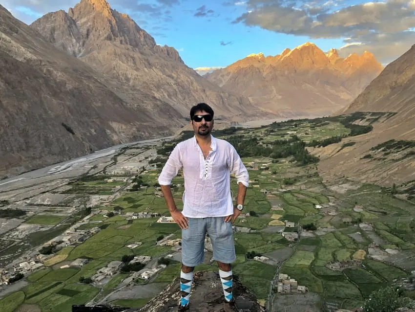
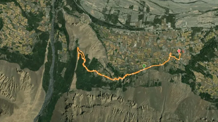
The wind, an old friend and a constant adversary, was already biting at my face as we began the trek from Shimshal village. Every step on this ancient path, carved by generations of Wakhi shepherds and hardy traders, felt like a journey back in time. My boots crunched on loose scree, the air thin and sharp, carrying the scent of juniper and glacial meltwater. This wasn’t some manicured trail; this was the raw, untamed heart of the Karakoram.
       [ Shimshal Village (3,100m) ➔ Pas Furzeen Gorge Trek ]
                                 │
       [ Extreme Undulating Cliffs ➔ Arbab Prian ➔ Shuijerab ]
                                 │
       [ Shimshal Pass High Base Camp Established (~4,700m) ]
                                 │
       [ Acclimatization Rotations ➔ High Camp I Established (5,300m) ]
                                 │
       [ Midnight Summit Bid (1 AM): Sustained 45° Hard Snow Slopes ]
                                 │
       [ 6,050m Apex Reached ➔ Drone Reconnaissance ➔ Return to Hunza ]
The Independent Alpine Approach
This sense of raw wilderness is exactly why I never rely on commercial expedition agencies. For me, the true essence of mountaineering lies in complete autonomy. I independently craft every aspect of my journeys—from mapping the routes and deciding the ascent windows to managing the complex logistics directly with local communities. Going unguided and bypassing corporate packages allows me to connect with the mountains on my own terms.
Our destination: Minglik Sar, a 6,050-meter sentinel rising majestically above the Shimshal Pass. People often call it a “non-technical snow peak,” but I’ve seen enough mountains to know that every 6,000er demands absolute respect. While it doesn’t have the sheer vertical ice walls of Haramosh or the exposed knife-edges of Laila Peak, Minglik Sar tests your endurance to the absolute limit.
We followed the Shimshal River, a turquoise ribbon carving its way through towering gorges. Days were spent traversing high pastures where yaks grazed placidly, their bells echoing in the vast silence. Each evening, as the sun dipped below the jagged horizon, painting the sky in fiery hues, I’d look east towards where Minglik Sar would eventually reveal itself.
The Toughest Pass in Pakistan: The Shimshal Traverse
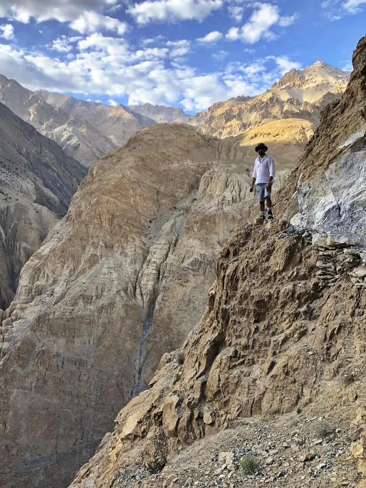
The trek to Shimshal Pass is widely considered the most difficult pass in Pakistan. It is not for the faint of heart. The route is characterized by extreme, grueling ascents up rocky cliffs, followed by sudden, knee-punishing descents. We covered significant ground daily, crossing these severe undulating terrains and navigating tricky sections of moraine.
Our porters, strong men from Shimshal who have carved these paths through unforgiving rock, moved with an almost supernatural ease. Their knowledge of these mountains is encyclopedic, their respect for them absolute.
We camped at places like Pas Furzeen, Arbab Prian, and Shuijerab, each site offering progressively more stunning, and more intimidating, views of the surrounding giants. Acclimatization was a constant, deliberate process. We’d gain altitude, then descend slightly to sleep lower, allowing our bodies to adapt to the decreasing oxygen levels. Rushing this stage is a rookie mistake, one that can have fatal consequences at these altitudes.
A Legacy of Hospitality: Sadaqah Jariyah in Shimshal
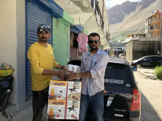
During my time traversing these rugged paths, I noticed something profoundly moving at the campsites. The hardworking locals who had carved these routes through the rocky mountains had left behind cookers, steel mugs, and basic utensils for public use. Any traveler could use them to boil water or cook a meal. It was a beautiful example of Sadaqah Jariyah—continuous, self-sustaining charity.
However, it didn’t feel right to simply consume their resources without giving back. I noticed that the chimneys used to vent smoke from the shelters were damaged and urgently needed repair. Realizing the immense value of this tradition, I decided to contribute. I purchased and donated my own cookers and steel mugs, and I also provided cash to the locals specifically to repair the broken chimneys.
I mention this not to show off, but to highlight a crucial point about mountaineering ethics. As climbers, we often exercise our right to use these communal resources, but we also share a profound responsibility to maintain and improve them for those who follow.
Route Architecture: 9-Day Expedition Itinerary Breakdown
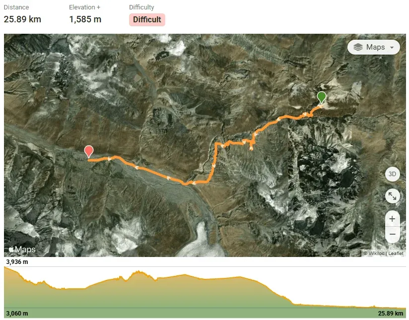
To help future climbers visualize the journey, I’ve mapped out our exact 9-day itinerary. These maps detail the daily distances, elevation gains, and the progressive difficulty of the trek from Shimshal Village to the summit and back.
Stage 1: Shimshal Village to Pas Furzeen (Day 1)
Departing the village along the canyon, following sheer rock ledges with severe drops to the riverbed.
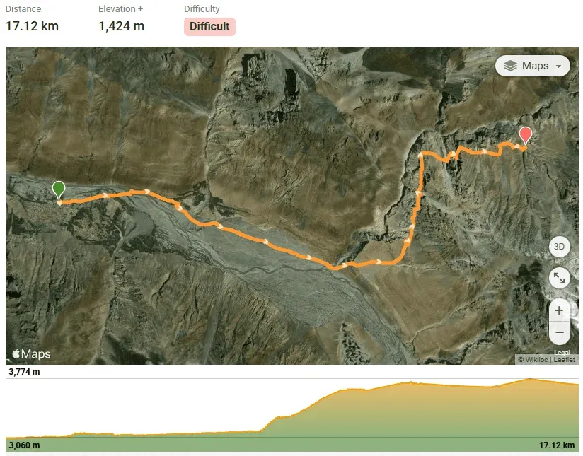
Stage 2: Pas Furzeen to Arbab Prian (Day 2)
Crossing steep undulating terrain, climbing out of the gorge onto high alpine yak pastures.
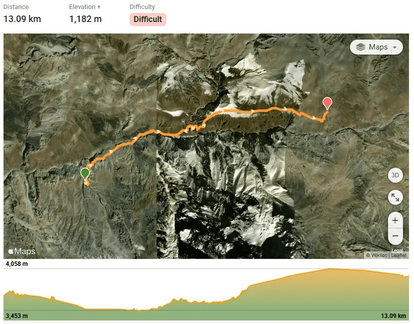
Stage 3: Arbab Prian to Shimshal Pass (Day 3)
Reaching the expansive grasslands and twin alpine lakes of Shimshal Pass (~4,700m).
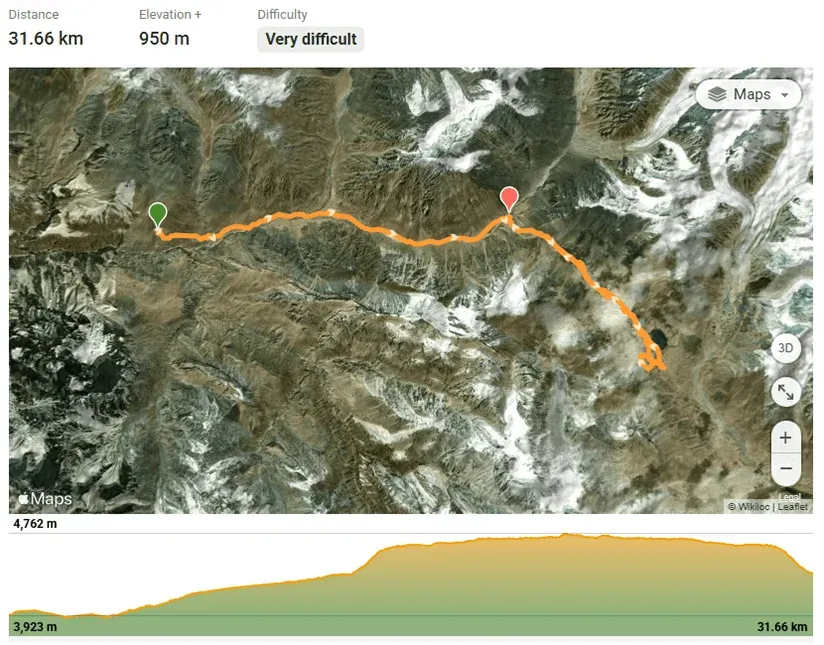
Stage 4: Shimshal Pass to Shuijerab (Day 4)
Moving into position at the summer pastures beneath the mountain massif for base operations.
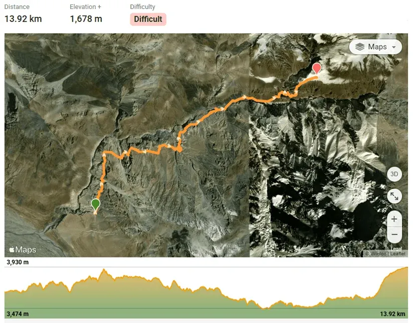
Stage 5: Acclimatization Hike (Day 5)
Ascending surrounding ridges above 5,000m and returning low to sleep, triggering essential RBC production.
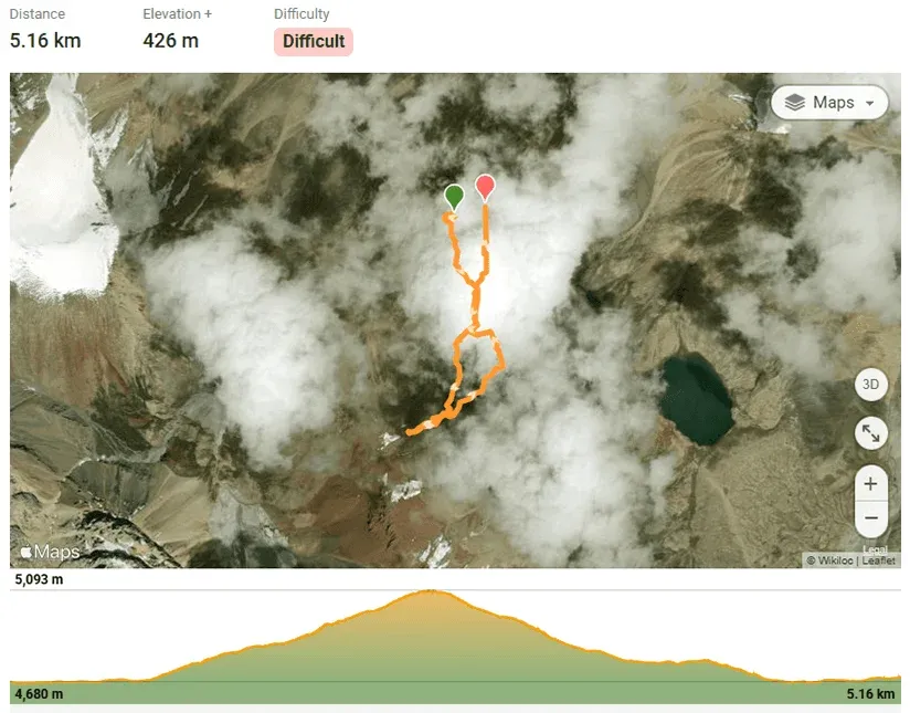
Stage 6: Establishing High Camp I (Day 6)
Hauling technical alpine gear onto the lower snow plateau at 5,300 meters.
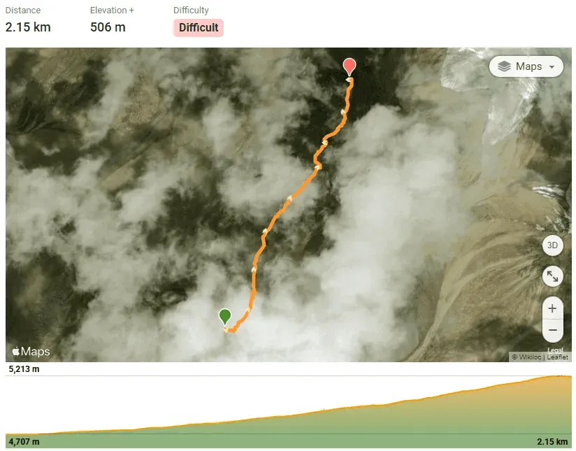
Stage 7: Summit Push to 6,050m (Day 7)
Midnight departure up 45-degree sustained snow slopes to the small windswept summit plateau.
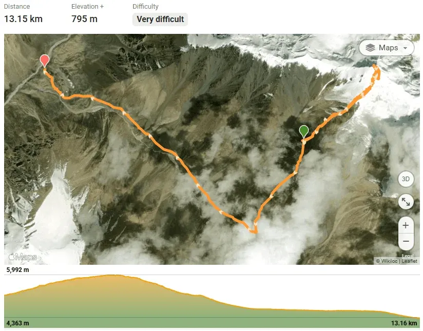
Stage 8 & 9: Descent via Shuijerab to Shimshal Village (Days 8–9)
Rapid descent down the gorge trail, returning safely to Shimshal Village to complete the expedition.
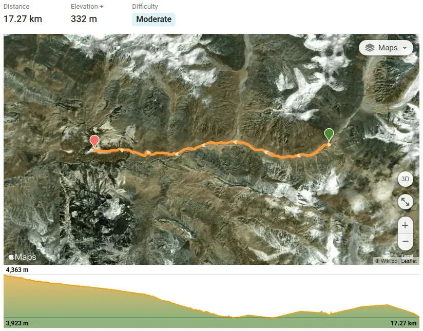
Reading the Mountain: Initial Reconnaissance at Shimshal Pass
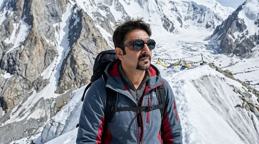
Upon arrival at Shimshal Pass (approximately 4,700 meters), the full majesty of Minglik Sar unfolded before us. From this vantage point, its south-western flank, the usual ascent route, looked deceptively gentle. However, my eyes were drawn to the subtle undulations, the hidden crevasses, and the glint of ice beneath the fresh snow.
Nazir Sabir made the historic first ascent in 1988, reportedly a one-day push from base camp, but conditions in the Karakoram are never static. Weather patterns, snow depth, and glacier movement constantly reshape the mountain.
Our initial days at base camp were dedicated to further acclimatization and intensive reconnaissance. We walked out onto the lower slopes, assessing snow conditions and identifying potential objective hazards like hidden crevasses.
The Alpine Push: Establishing High Camp at 5,300m
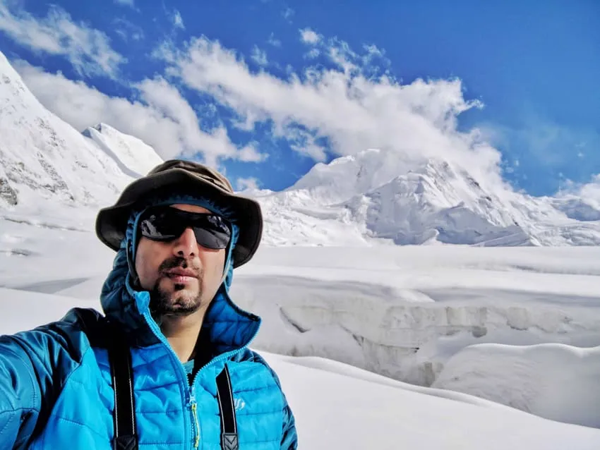
The morning we established Camp I at exactly 5,300 meters was crisp and clear, a good omen. We pushed up from Shimshal Pass (4,700m), initially traversing wide, open snowfields. The incline was a gradual 25-degrees, allowing us to maintain a steady pace and conserve energy over the 3-kilometer horizontal distance for the real challenges ahead. Our team worked efficiently, setting up tents, melting snow for water, and preparing for the next day’s push. The thin air meant every task, no matter how simple, required conscious effort.
While Minglik Sar lacks the extreme verticality of Spantik, its upper slopes often present significant challenges, especially depending on snow conditions. We encountered sections of steeper ice that, while not requiring extensive fixed lines, demanded precise crampon work and solid ice axe placements. We climbed in rope teams, maintaining proper spacing, each climber focused on the task at hand. The broad, seemingly benign snow slopes hide deep crevasses, meaning our route-finding had to be meticulous.
Summit Day: A Dance with the Sky to 6,050m Apex
The alarm shattered the pre-dawn silence at 1:00 AM. Outside, the world was a frozen tableau, illuminated by a sliver of moon and the pinpricks of a billion stars. We brewed hot liquids, forced down some food, and began our final ascent with headlamps cutting swathes through the darkness.
The first few hours climbing above Camp I (5,300m) were a grueling grind up sustained 45-degree snow slopes. Our crampons bit into the hard-packed snow with a satisfying crunch. The breathing was labored, each step an effort of will in the biting -15°C cold. As dawn approached, the eastern sky began to blush with vibrant colors, revealing the vast expanse of the Karakoram, an ocean of jagged peaks stretching to the horizon.
The final 200 meters to the summit were the most challenging. The angle steepened significantly, and the snow was deeper in places, requiring us to kick steps. On the exposed col leading to the summit ridge, the wind truly unleashed its fury. But my team was resolute, moving as one, driven by the trust we had built.
On Top of the World: Perspective from the Summit Ridge
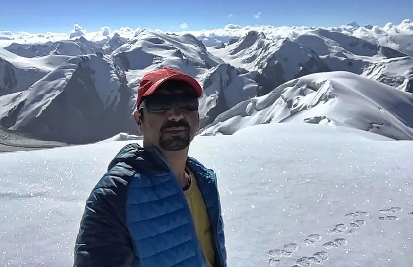
And then, there it was. A small, windswept plateau, barely enough room for all of us to stand. The feeling is indescribable—not euphoria, but a profound sense of achievement and quiet triumph. The panorama was staggering. North towards the Shimshal Pass and beyond, south into the heart of Hunza, the entire world seemed to lay at our feet. The views of Distaghil Sar and Shimshal Whitehorn were magnificent.
We spent only a few precious minutes on the summit. The descent, often more dangerous than the ascent, lay ahead. I checked on each team member, shared quick congratulations, and gave the order to begin our descent. Risk management isn’t just about getting to the top; it’s about getting everyone down safely.
Descent Logistics: Safely Returning Through the Gorge
Climbing Minglik Sar is more than just bagging a peak; it’s an immersion into the unique culture of Shimshal and an adventure into one of the wildest corners of the Karakoram. This mountain provides an incredible platform for developing mountaineering skills and experiencing the true grandeur of the Greater Ranges. It’s an excellent stepping stone for those aspiring to higher peaks.
Descending through the undulating cliffs of the Shimshal Pass gorge tested our quad strength far more than the climb itself. The narrow goat tracks, loose shale, and afternoon river surges required continuous vigilance. Reaching Shimshal Village was a triumphant relief—warm greetings, fresh tea, and the deep satisfaction of an unassisted Karakoram summit.
Minglik Sar Expedition Strategy Ledger and Fact File
Success on high-altitude 6,000-meter peaks requires disciplined acclimatization, strict downhill training, and deep cultural respect for local communities.
Strategic Expedition Takeaways
- Respect the Pass: Do not underestimate the trek to Shimshal Pass. The continuous cycles of extreme ascent and sudden descent make it the toughest pass in Pakistan. Train specifically for downhill knee endurance.
- Architect Your Own Journey: Instead of booking a commercial package, organize logistics directly with local Wakhi guides and porters in Shimshal. It ensures total operational control and directly supports the local village economy.
- Contribute to the Trail: If you use communal utensils or stone shelters, leave something behind for the next group. Bring extra mugs or gas canisters as your own continuous charity (Sadaqah Jariyah).
- Rope Team Discipline: Do not let the “non-technical” label deceive you. The snow slopes conceal deep crevasses; always stay roped up across the upper snowfields above 5,000 meters.
Minglik Sar Expedition Fact File
| Parameter | Expedition Specification |
|---|---|
| Mountain Name | Minglik Sar (Mingling Sar / Manglik Sar) |
| Elevation | 6,050 meters (19,849 ft) |
| Mountain Sub-range | Karakoram Range (Shimshal Valley) |
| Location | Hunza District, Gilgit-Baltistan, Pakistan |
| Approach Route | Shimshal Village ➔ Pas Furzeen ➔ Arbab Prian ➔ Shimshal Pass |
| Base Camp Elevation | Shimshal Pass: approx. 4,700 meters (15,420 ft) |
| High Camp Elevation | Camp I: approx. 5,300 meters (17,388 ft) |
| First Historic Ascent | 1988 (Nazir Sabir, first solo ascent) |
| Climbing Grade | Alpine Grade I / PD (Moderate snow slopes & crevasse fields) |
| Summit Temperatures | -10°C to -20°C (with severe pass winds) |
| Recommended Season | June to September |
Frequently Asked Questions About Minglik Sar
What is the exact elevation and location of Minglik Sar?
Minglik Sar stands at an elevation of 6,050 meters (19,849 feet) in the Karakoram Range. It is located beyond the remote Shimshal Pass in the upper Hunza District of Gilgit-Baltistan, Pakistan.
Why is the trek to Shimshal Pass called the toughest pass in Pakistan?
Unlike standard continuous ascents, the route to Shimshal Pass follows severe undulating terrain along narrow gorge cliffs. Trekkers must repeatedly endure brutal vertical climbs followed by immediate steep descents over loose scree, requiring exceptional downhill quad endurance and mental resilience.
Is Minglik Sar technically difficult, and can beginners climb it?
Minglik Sar is rated Alpine Grade I / PD (Peu Difficile) and is considered a non-technical snow peak. It does not require vertical rock or ice climbing. However, it is not a casual hike; climbers must navigate hidden crevasse fields, travel on rope teams, use crampons and ice axes on 45-degree snow slopes, and endure 6,000m altitude.
How long does the complete Minglik Sar expedition take?
The entire expedition typically spans 14 to 18 days round-trip from Islamabad, with 8 to 10 days dedicated to the trek from Shimshal Village, acclimatization at Shimshal Pass (4,700m), establishing High Camp I (5,300m), and the summit bid.
What peaks can you see from the summit of Minglik Sar?
The summit offers one of the most magnificent 360-degree panoramas in the Karakoram, including views of K2, Broad Peak, Distaghil Sar (7,885m), Shimshal Whitehorn, Momhil Sar, and the vast Chinese Shaksgam borders to the north.
What mountaineering gear is required for Minglik Sar?
Required gear includes crampon-compatible mountaineering boots, 10- or 12-point crampons, a technical ice axe, a climbing harness, dynamic ropes for glacier travel, a four-season tent, a sub-zero sleeping bag (-15°C to -20°C), and high-altitude thermal windproof layers.
What is the best time of year to climb Minglik Sar?
The best season is mid-summer, spanning from late June to early September. During this window, snow conditions on the summit slopes are more consolidated, temperatures are relatively manageable, and the lush pastures around Shimshal Pass are populated by Wakhi families and yak herds.
How does Minglik Sar compare to Spantik or Koser Gunge?
Minglik Sar (6,050m) is lower and technically more forgiving than Spantik (7,027m), which involves sustained 50-degree ice headwalls and -30°C death zone exposure. However, Minglik Sar's approach trek through Shimshal Pass is considerably more physically grueling and undulating than the approach to Koser Gunge or Spantik.
Ready for Your Next Karakoram Objective?
Are you planning an independent trek to Shimshal Pass or preparing for your first 6,000-meter Karakoram peak? Connect with Goher K to discuss expedition logistics, gear selection, and local guide arrangements. Discover more alpine stories in Mountaineering Expeditions.