
· Goher K · Mountaineering · 16 min read
Spantik 7,027m Expedition: Southeast Ridge Karakoram Alpine Ascent
Complete guide to Spantik (7,027m Golden Peak). Discover Southeast Ridge alpine routes, high camps, sub-zero survival, and the Chogo Lungma glacier approach.
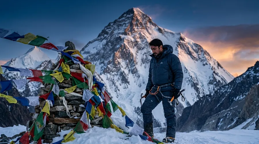
Spantik (7,027m / 23,054ft), famously known as the Golden Peak, is a striking pyramid mountain in the Spantik-Sosbun Mountains of the Karakoram Range in Gilgit-Baltistan, Pakistan. Celebrated for its golden marble wall that ignites at sunrise and sunset, Spantik is considered the premier transitional peak for mountaineers stepping from 6,000m peaks into 7,000m and 8,000m alpine expeditions. The classic Southeast Ridge (Normal Route) via the Chogo Lungma Glacier offers a continuous, non-technical to moderately technical Grade 2 snow-and-ice arête with 50-degree ice headwalls. This expedition chronicle outlines Goher K's independent, non-commercial alpine ascent, detailing high-camp rotations, -30°C ridge survival, winter gear specifications, and community outreach in Arandu.
The Call of the Golden Peak: Skardu to Arandu Gateway
The dust motes danced in the late afternoon sun, kicked up by our boots on the trail leading to Spantik Base Camp. Every step was a conversation with the Karakoram, a slow, deliberate approach to the mountain we affectionately call the Golden Peak. My team, a mix of seasoned climbers and ambitious newcomers, moved with a quiet determination.
Our journey began in Skardu, from where we took a rugged jeep ride, crossing the entire Shigar Valley. We arrived at Arandu (also spelled Arando), a remote, high-altitude border settlement that stands as the very last village of the Shigar Valley in Gilgit-Baltistan. Arandu is the true gateway to the Chogo Lungma Glacier.
       [ Skardu / Shigar Valley Overland ➔ Arandu Gateway ]
                                 │
       [ Chogo Lungma Glacier Trek ➔ Bolocho Camp (Acclimatization) ]
                                 │
       [ Spantik Base Camp Established (4,300m) ]
                                 │
       [ Staged High Camps: C1 (5,100m) ➔ C2 (5,650m) ➔ C3 (6,295m) ]
                                 │
       [ Midnight Summit Push (2 AM): Knife-Edge Corniced Ridge ]
                                 │
       [ 7,027m Apex Reached ➔ Rappel Descent ➔ Return to Skardu ]
Beyond the Summit: Winter Shoe Outreach in Arandu
The mountains give us so much—unbreakable resilience, profound clarity, and an overwhelming sense of humility. But a summit is only half the journey. For me, the true essence of any expedition lies in the resilient communities that call these unforgiving landscapes home.
Whenever I embark on a project or an expedition, my first destination isn’t the base camp; it’s the local schools nestled in these remote valleys. I always make it a point to sit down with the principals and teachers, asking a simple question: “What do the children need?” Whether it is uniforms to wear with pride, food for nourishment, or just warm gear to fight the biting cold, I try to fulfill that requirement.
For the Spantik expedition, I learned that the children in the local valley were in desperate need of sturdy winter shoes. Providing them wasn’t an act of charity—it was a humble token of gratitude to the people whose majestic backyard I am privileged to climb. Seeing the pure, unfiltered joy on their faces as they tried on their new shoes carried just as much weight in my heart as standing on the summit of the Golden Peak itself.
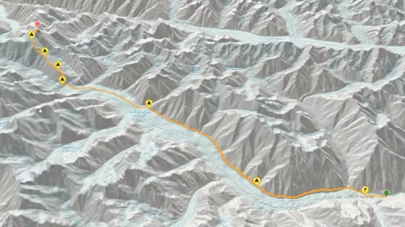
Route Architecture: Visualizing the Southeast Ridge
Spantik’s Southeast Ridge—our chosen route—presents itself with a deceptive elegance. It’s the standard route, first climbed in 1955, and it offers a direct, albeit challenging, line to the summit. Here is the visual breakdown of the route we followed from Arandu all the way to the 7,027m peak:
Independent Alpine Philosophy: Rejecting Pre-Packaged Expeditions
Most tour operators will hand you a dry, pre-packaged 28-day itinerary, but I wouldn’t know—because I never use them. My philosophy for any expedition is total independence. I do not hire commercial mountaineering companies or agencies. Instead, I approach every mountain like a complex architectural project: I spend months doing my own rigorous R&D, studying historical references, and plotting custom routes on Google Earth and maps.
I design the entire expedition from scratch. I directly hire, communicate, and negotiate with the local guides and porters, finalizing all commitments face-to-face. This direct connection not only ensures that the local community benefits fully but also gives me complete control over the logistics, the pace, and the survival strategies. Out here on Spantik, there was no hand-holding or commercial safety net; there was only the raw, unfiltered reality of the mountain, navigated entirely on our own terms.
Phase 1: Overland Approach Through the Shigar Valley
The journey begins far from the ice. After flying into Skardu (or driving via Chilas when the weather decides otherwise), we spend a day finalizing logistics, checking gear, and soaking in the raw energy of the town. A grueling overland transfer takes us through the Shigar Valley—the same rugged terrain that serves as the approach for Koser Gunge (6,401m)—to Arandu. The landscape turns wilder, the slopes steeper. Pitching our first camp in Arandu, distributing loads, and looking toward the glacier, the reality of the expedition finally sets in.
Phase 2: Navigating the Chogo Lungma to Base Camp (4,300m)
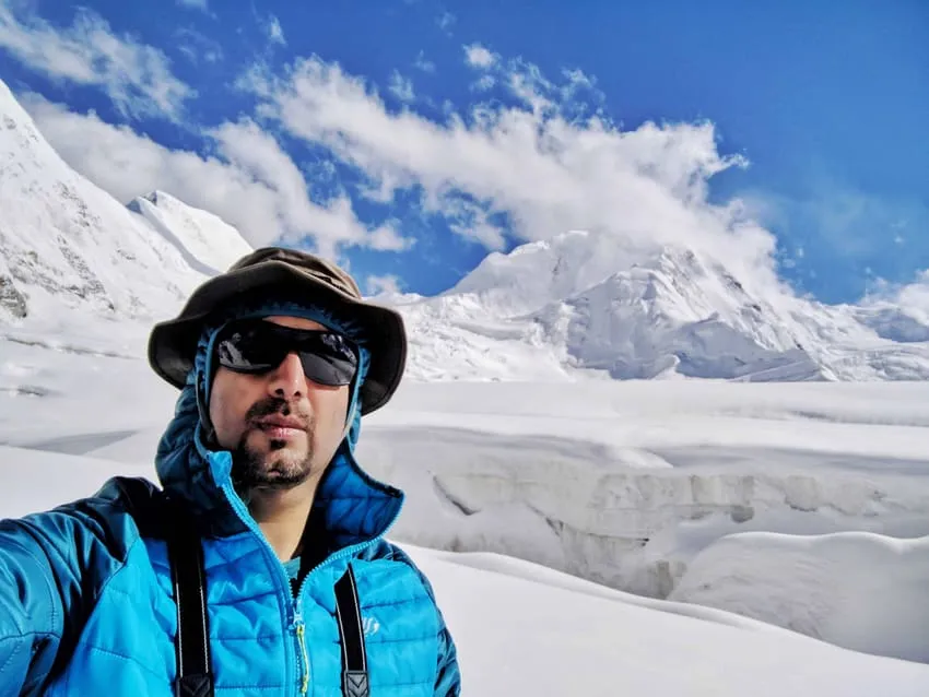
Leaving Arandu, we step onto the Chogo Lungma, a formidable river of ice and rock. Progress is gradual, essential for acclimatization. The rhythmic chants of our hardy local porters echo across the vast expanse of ice. We establish our camp at Bolocho, surrounded by the jagged amphitheater of the Karakoram. By Day 6, we traverse mixed rock-and-ice terrain to finally establish Spantik Base Camp at 4,300 meters. Day 7 is an active rest day—checking equipment, reviewing weather models, and discussing rotation strategies.
Phase 3: High-Camp Rotations and Technical Ice Aretes
This is where the real work begins. We establish a network of high camps: Camp 1 at 5,100m, navigating soft snow and crevasses; Camp 2 at 5,650m, battling steep, 60-degree ice walls that demand precise axe work; and finally, Camp 3 at 6,295m—a bleak, windswept perch on an exposed arête.
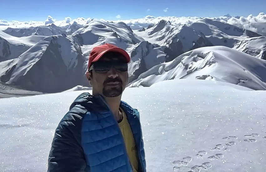
Our acclimatization cycles (climbing high, sleeping low) are brutal but vital. The temperature drops below -25°C. When the weather window opens, we launch our Alpine-style summit push at 2 AM. The final summit ridge is a terrifying corniced crest. On one side, the colossal expanse of the Karakoram—home to other formidable objectives like Pamiri Sar (7,016m) and the iconic Laila Peak (6,986m)—and on the other, a dizzying void. Reaching the 7,027m summit is a moment of profound, quiet awe—looking down at K2 and Broad Peak standing in majestic silence.
Experience the reality of this vertical world in this 30-second summary from the high camps to the summit:
The Midnight Summit Bid: Standing on the 7,027m Crest
Launching into the frozen blackness at 2:00 AM, the cold was immediate and penetrating. Every step on the exposed arête above 6,500 meters required unwavering focus. Above High Camp 3, the Southeast Ridge narrows into an aesthetic but unforgiving snow arête guarded by cornices that curl out into thousands of feet of exposure.
Pacing became our salvation. Matching our breathing to disciplined crampon placements, we pushed through the freezing pre-dawn hours. When the morning sun finally broke across the Karakoram horizon, the golden walls of Spantik erupted into glowing fire, and the summit ridge flattened out. Standing at 7,027 meters (23,054 ft), we were greeted by panoramic views extending from Nanga Parbat in the west to the crown of K2 and Broad Peak in the east.
Phase 4: Alpine Descent and Return to Civilization
The summit is only halfway, and the descent is often the most dangerous part. Battling extreme fatigue, we rappel down the fixed lines, dismantling high camps and retreating to Base Camp. From there, we trek back across the glacier to Arandu, and finally return to Skardu for a much-needed hot shower and an informal celebration, before heading back to Islamabad.
Technical Reality: Grade 2 Mountaineering and Critical Gear
Spantik is often labeled as the “easiest 7000m peak” because it lacks extreme objective dangers. But let me be clear: “non-technical” does not mean it is a trekking peak. It is a serious Grade 2 mountain climb that demands ultimate respect.
Essential High-Altitude Gear Recommendations
I have seen climbers suffer immensely due to poor gear choices. Here is what I never compromise on:
- Boots: High-altitude double or triple-layered plastics are non-negotiable to avoid frostbite. I personally rely on La Sportiva Spantik boots. Never bring brand-new boots to a 7,000m peak—break them in first.
- Crampons: You need 12-point mountaineering crampons with anti-balling plates that specifically fit your plastic boots.
- Down Suit / Jacket: You will face -25°C to -30°C. A high-loft down suit or a premium down jacket is worth every single penny.
- Sleeping Gear: Bring two high-altitude sleeping bags (one rated for -15°C at Base Camp, and one rated for at least -25°C for the higher camps).
Spantik Expedition Strategy Ledger and Fact File
High-altitude success requires meticulous planning, staged acclimatization cycles, and relentless gear discipline.
Strategic Expedition Takeaways
- The Acclimatization Ladder: Never rush the progression between High Camp 1 (5,100m), Camp 2 (5,650m), and Camp 3 (6,295m). The “climb high, sleep low” rule protects against high-altitude pulmonary edema (HAPE).
- Ridge Exposure Discipline: The upper arête on Spantik features large cornices overhanging the sheer South Face. Always stay strictly on the windward side of the snow ridge and rope up across crevasse fields.
- Direct Porter Partnerships: Negotiating directly with Balti guides and porters in Arandu creates trust, ensures fair compensation, and gives the expedition leader direct operational command over rotations.
- Double-Boot Insulation: Sub-zero temperatures on summit day easily dip past -25°C. Technical double boots with thermo-moldable liners prevent catastrophic frostbite.
Spantik Expedition Fact File
| Parameter | Expedition Specification |
|---|---|
| Mountain Name | Spantik (Golden Peak / Ghenish Chhish) |
| Elevation | 7,027 meters (23,054 ft) |
| Mountain Sub-range | Spantik-Sosbun Range, Karakoram |
| Location | Gilgit-Baltistan, Pakistan (Nagar/Shigar border) |
| Approach Route | Arandu (Shigar Valley) ➔ Chogo Lungma Glacier |
| Base Camp Elevation | 4,300 meters (14,107 ft) |
| High Camp Network | Camp 1 (5,100m) • Camp 2 (5,650m) • Camp 3 (6,295m) |
| Climbing Grade | Alpine Grade II / AD (Moderate technical snow & ice) |
| Summit Temperatures | -15°C to -30°C (with severe windchill) |
| Typical Expedition Duration | 24 to 28 days (Islamabad to Islamabad) |
| Primary Climbing Season | July to August |
Frequently Asked Questions About Spantik Peak
What is the Southeast Ridge route of Spantik?
The Southeast Ridge route is the classic normal route that ascends Spantik from the Chogo Lungma Glacier. First climbed in 1955, it features a logical sequence of three high camps leading up moderate glacier terrain and a long, corniced snow-and-ice arête directly to the 7,027m summit.
How long does it typically take to climb Spantik via the Southeast Ridge?
The ascent usually takes around 24 to 28 days round-trip from Islamabad. This timeline includes the 4-day overland and trekking approach through Arandu, rotational acclimatization cycles between Camps 1, 2, and 3, weather contingency days, and the final summit push.
Is Spantik suitable as a first 7,000-meter peak for aspiring 8,000m climbers?
Yes. Spantik is widely considered the ideal stepping-stone peak for mountaineers preparing for 8,000-meter giants like Broad Peak, Gasherbrum II, or Everest. It introduces climbers to high-altitude physiological realities, extended sub-zero camp life, and fixed-line rope work without excessive objective rockfall hazards.
What technical climbing difficulty rating is Spantik?
Spantik is rated Alpine Grade II (AD - Assez Difficile). While it does not require vertical rock climbing, it features sustained 40- to 50-degree hard snow and ice slopes between Camps 2 and 3, crevasse navigation, and an exposed knife-edge summit arête with severe wind exposure.
What are the primary objective hazards on the Southeast Ridge of Spantik?
The primary hazards include sudden Karakoram blizzards, hidden glacial crevasses on the lower plateau, large cornices along the upper arête, and rapid-onset altitude sickness. Frostbite is a constant threat when temperatures plummet below -25°C during the night and early morning summit bid.
What boots, crampons, and gear are essential for Spantik?
Crucial gear includes technical double mountaineering boots (such as La Sportiva Spantik or Olympus Mons), 12-point steel crampons with anti-balling plates, an 800+ fill-power expedition down suit, high-altitude sub-zero sleeping bags rated to -25°C, dynamic ropes, and ice axes.
What is the best season and weather window for climbing Spantik?
The optimal window for climbing Spantik is mid-summer, spanning July through mid-August. During this period, daytime conditions in Gilgit-Baltistan are generally more stable, daylight hours are longest, and snow consolidation on the high arête offers safer climbing.
How does Spantik compare to nearby peaks like Laila Peak or Haramosh?
While Spantik (7,027m) is higher than Laila Peak (6,986m), Laila Peak is far steeper and technically demanding with a 55-degree spearhead of mixed rock and ice. Haramosh (7,409m) is significantly more dangerous than Spantik, featuring complex serac falls and severe avalanche chutes that have claimed numerous expeditions.
Ready for Your Next High-Altitude Objective?
Are you planning an independent Karakoram expedition or interested in applying high-altitude endurance principles to Enterprise Architecture? Connect with Goher K to discuss mountain logistics, route strategies, and real-world alpine experiences. Explore more detailed chronicles in Mountaineering Expeditions.