
· Goher K · Mountaineering · 16 min read
Musa ka Musalla 4,080m Trek: Siran Valley High Plateau Summit Guide
Complete guide to the Musa ka Musalla trek (4,080m). Discover the Siran Valley route, high-altitude camps, weather survival, and camping on the summit plateau.
Expedition Overview
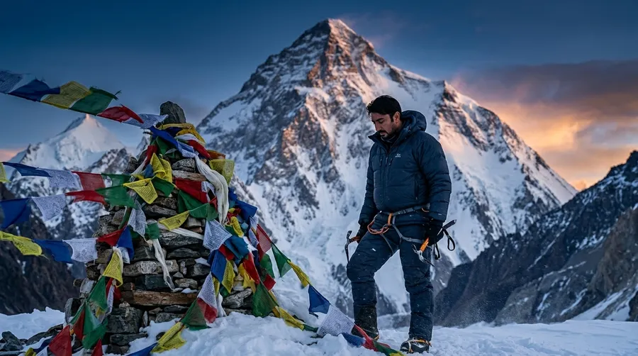
Musa ka Musalla (4,080m / 13,386 ft)—meaning "Moses' Prayer Mat"—is a prominent alpine peak and expansive high-altitude plateau situated at the junction of the Siran and Kaghan Valleys in Khyber Pakhtunkhwa, Pakistan. Approached via Munda Gucha through ancient deodar forests, alpine pastures (Jabar, Khorri), and a steep scree ascent above Bolocho, the route demands a continuous 2,180-meter vertical gain. While technically non-glaciated during summer, its exposed topography triggers violent squalls, sub-zero wind chills, and relentless ridge switchbacks. In May 2025, mountaineer Goher K and his wife completed an independent couple ascent during Ramazan, carrying their own shelter past reluctant local guides to achieve the first recorded couple summit tent campover on the 4,080m apex plateau.
| Specification Metric | Technical Expedition Data |
|---|---|
| Geographic Location | Siran & Kaghan Valley Junction, Mansehra, KP, Pakistan |
| Apex Elevation | 4,080 meters (13,386 feet) |
| Mountain Range | Lesser Himalayas / Hazara Alpine Arc |
| Trailhead / Roadhead | Munda Gucha Village (1,900m), Upper Siran Valley |
| Total Vertical Ascent | +2,180 meters elevation gain from valley floor |
| Standard Expedition Window | 3 to 4 Days (Approach march, high camp, and summit) |
| Technical Climbing Grade | Grade II Alpine Endurance Trek (Relentless scree & ridge traverse) |
| Primary Alpine Hazard | Sudden localized blizzards, hypothermia & hurricane-force summit gales |
| Historic Couple Feat | First recorded couple summit overnight tent camp at 4,080m |
| Best Climbing Season | Late May to September (Summer pastures & clear ridge lines) |
📋 Expedition Field Guide & Table of Contents
The Call of the Siran Valley: An Alpine Pilgrimage
Musa ka Musalla, which translates poetically to “Moses’ Prayer Mat,” stands as a massive, brooding presence at 4,080 meters in the Khyber Pakhtunkhwa province of Pakistan. Unlike the razor-sharp, glaciated spires of the Karakoram—such as Spantik, Laila Peak, or Haramosh—Musa ka Musalla culminates in an immense, high-altitude plateau. But do not let the absence of technical ice walls fool you: rising more than 2,100 vertical meters from the valley floor, this mountain is a relentless cardiovascular crucible that demands disciplined acclimatization, mental resilience, and absolute respect for alpine weather volatility.
My journey to Musa ka Musalla began deep within the Siran Valley. Densely forested and fed by glacial runoff, the Siran Valley provides an emerald backdrop for the early stages of the ascent. This route has long served as one of my favorite training grounds for dialing in base aerobic conditioning before tackling technical 6,000m and 7,000m objectives like Minglik Sar or Koser Gunge.
However, this expedition was defined by an entirely different purpose. I was not climbing solo or directing a large commercial mountaineering party. This was an intimate, deeply personal odyssey—a summit push alongside my wife. Negotiating severe altitude while supporting the person you love introduces an entirely new dimension to mountaineering. It requires vulnerability, unspoken communication, and mutual trust that technical climbing alone can never replicate.
Route Architecture: Visualizing the Siran Valley Ascent
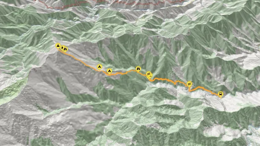
To successfully climb Musa ka Musalla via the Siran Valley route, an alpinist must understand the gradual transition from temperate river valleys to wind-scoured sub-alpine ridges. The route begins at Munda Gucha (approx. 1,900m), winds through terraced agriculture, penetrates dense cedar groves up to Jabar (2,600m), establishes intermediate camps at Khorri (2,900m) and Bolocho (3,450m), and finishes with an unbroken 630-meter scree grind to the 4,080m summit plateau:
[Munda Gucha Roadhead (1,900m)]
               │
               ▼ (+700m / Ancient Deodar & Pine Forest)
[Jabar Alpine Meadow (2,600m)]
               │
               ▼ (+300m / River Forwards & High Pastures)
[Khorri Camp (2,900m)]
               │
               ▼ (+550m / Continuous Steep Grunt Beyond Treeline)
[Bolocho High Camp (3,450m)] ── Guide Turnaround Point
               │
               ▼ (+630m / Relentless Scree Switchbacks & Gali Ridge)
═════════════════════════════════════════════════════════════════
[Musa ka Musalla Summit Plateau (4,080m)] ── Couple Campover Apex
═════════════════════════════════════════════════════════════════
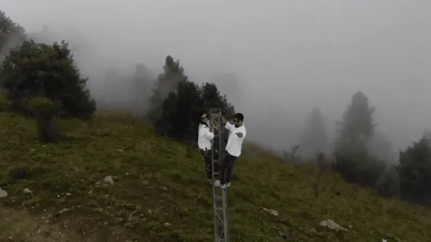
The geographical overview below illustrates our complete track from the Siran riverbank across the alpine tree-line to the sweeping prayer-mat crest:
The Approach: Ancient Forests, High Pastures and Ramazan
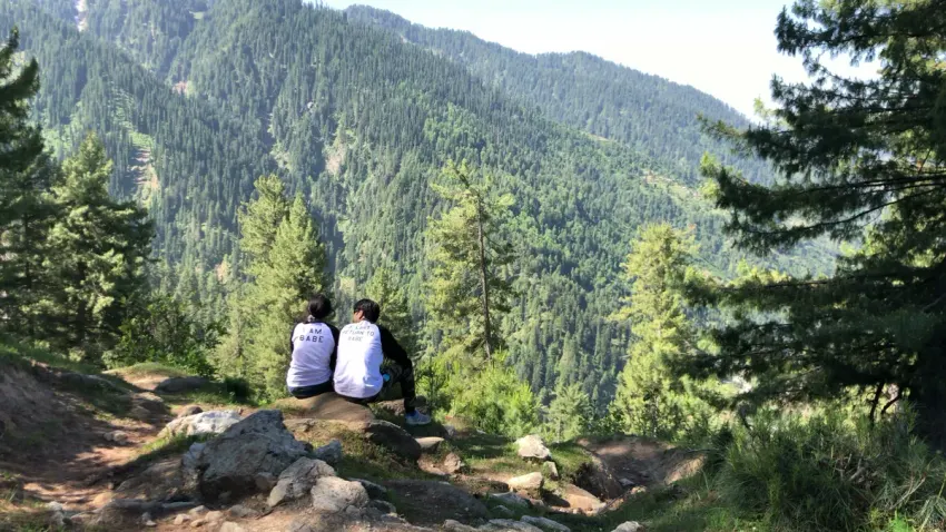
The initial miles from Munda Gucha present a deceptive serenity. As we moved along the Siran River, the crisp morning air was saturated with the scent of wet soil, pine resin, and wild mountain mint. In high-altitude expeditions, the pace you set during the first three hours determines your physiological endurance forty-eight hours later. As an expedition leader, I constantly regulate energy expenditure; as a husband, I synchronized my gait with my partner’s natural stride. Rushing early lower slopes on an ascent that gains 2,180m guarantees severe fatigue and early acute mountain sickness higher up.
What transformed this trek into a spiritual test was our timing: we were fasting. It was the final roza of the holy month of Ramazan.
Trekking under an intense mountain sun with zero caloric intake or water intake requires rigorous physiological self-control. Every calorie burned must be rationed; hydration must be maintained entirely through deliberate pre-dawn fluid intake (sehri).
As we ascended past the treeline above Jabar, the lush deodars gave way to sweeping alpine pastures dotted with early summer flora. The vibrant valley greens gradually faded into weathered granite boulders, loose scree, and patches of late-melting winter snow. Birds of prey soared on thermal updrafts overhead, while distant herds of Himalayan ibex navigated the crags above, reaffirming that we were leaving human civilization behind.
The Physical Demand at 4,080 Meters: Building Endurance
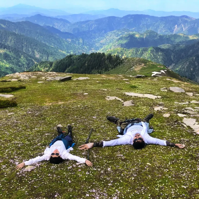
By the time we established our staging camp, the physical reality of altitude made itself known. While 4,080 meters does not approach the extreme hypoxia of the 8,000-meter death zone, the reduction in barometric pressure is substantial. At this elevation, atmospheric pressure is roughly 60% of sea level. Combined with severe fasting and heavy 45-pound expedition rucksacks loaded with four-season tents, sleeping bags, and cold-weather gear, every movement demanded conscious willpower.
The upper trail out of Bolocho transitions into an uninterrupted series of steep scree switchbacks. There are no technical crevasse fields or vertical ice bulges, but the angle of incline is unrelenting. Much like our previous high-altitude couple ascents on Miranjani and the steep alpine ridges of Makra Peak and Churko Peak, the crux of Musa ka Musalla is sustained mental tenacity.
When climbing as a couple, the physical load becomes a collective emotional commitment. When calf muscles cramp and cold alpine air bites into your throat, you draw strength from your partner’s steady rhythm. Sharing that burden makes every agonizing step deeply purposeful.
Battling Unpredictable Weather: The Tent Mutiny at Bolocho
Musa ka Musalla is notorious across the Hazara Division for its capricious weather patterns. Clear morning skies frequently deteriorate into ferocious thunderstorms, hail, or blinding snow squalls by early afternoon. Knowing this reality, we held an ambitious, non-negotiable objective: to pitch our four-season tent directly on the 4,080-meter summit and camp overnight.
When we reached Bolocho high camp at 3,450 meters and disclosed our summit camp plan to our local guides, an outright revolt ensued.
With over 18 years of guiding experience on Musa ka Musalla, the local team vehemently refused to proceed with the tent. They explained that hurricane-force summit gusts, sub-zero drops, and exposed electrical lightning on the prayer plateau make an overnight camp suicidal. In their entire career, no expedition—and certainly no married couple—had ever pitched a shelter on the apex. Their protocol was strict: hike to the top, touch the summit cairn for five minutes, and immediately retreat to the safety of Bolocho.
When the guides refused to carry our expedition tent higher, the decision was immediate. We thanked them, took possession of our shelter, strapped the heavy poles and canvas to our own packs, and initiated the final, punishing ascent independently.
The Plateau of Prayers: A Freezing, Romantic Summit Night
After four hours of grinding up frozen scree against gale-force gusts, the vertical pitch suddenly softened. We stepped onto the summit of Musa ka Musalla—the legendary Plateau of Prayers.
The summit is breathtakingly unique: a vast, billiard-table-flat alpine expanse perched 4,080 meters into the atmosphere, completely encircled by the jagged relief of the Kaghan and Siran ranges. Standing upon it feels akin to stepping onto a frozen island adrift in the sky.
The weather lived up to its reputation. As dusk descended, temperatures dropped steeply into negative figures. The wind shrieked across the open plateau with uninterrupted fury. Securing our four-season tent required disciplined mountaineering technique: we anchored each guy-line with heavy granite rocks, piled frozen turf against the snow valances, and double-checked every stake.
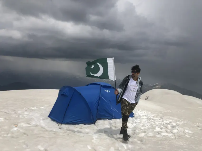
Inside our compact shelter, sealed off from the howling gale, the exhaustion melted into quiet serenity. We broke our fast, wrapped ourselves in sub-zero down bags, and celebrated our summit night on the roof of the Hazara Himalayas. Looking out through the tent vestibule toward the distant, glowing silhouettes of Nanga Parbat and the Hindu Kush, a profound sense of awe and romance filled the space. While I have negotiated much higher, far more perilous Karakoram giants like Pamiri Sar, the emotional resonance of that night on Musa ka Musalla remains unmatched.
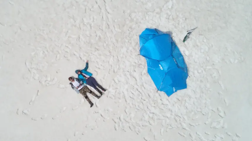
The raw reality of the conditions on the summit plateau is captured in the unedited field footage below, showcasing the biting gale-force winds we weathered through the night:
The Descent: Making History on the High Plateau
Dawn broke across the summit plateau with crystal clarity. The gale eased, revealing 360-degree vistas stretching across Kashmir, the Malika Parbat massif, and the snow-capped borders of Kohistan. We spent a quiet morning documenting the landscape, breaking camp with zero trace left behind, and preparing our knees for the relentless 2,180-meter descent back to the Siran Valley floor.
When we eventually rejoined our guides at base camp, the atmosphere had shifted from apprehension to utter disbelief.
The team could scarcely believe we had not only survived the summit night in freezing gale-force conditions, but had returned uninjured and energized. In nearly two decades of guiding on this mountain, our guides attested that no married couple had ever established camp on the prayer-mat plateau. Our little piece of alpine history had been quietly written.
Building the Alpine Foundation: Preparation and Training
Musa ka Musalla must not be dismissed as a standard weekend hike. Its continuous 2,180m vertical gain, rapid weather shifts, and severe nighttime temperatures make it a serious alpine objective. For aspiring trekkers seeking to bridge the gap between walking paths and high-altitude Himalayan expeditions, it serves as the ultimate laboratory. It tests your gear selection, cold-weather camping discipline, and mental resilience under physical duress.
Are you planning an alpine trek or looking to push your high-altitude endurance on Pakistan’s ridges? Connect with Goher K to discuss expedition logistics, equipment selection, and mountain conditioning. Explore more firsthand accounts in Mountaineering Expeditions.
Musa ka Musalla Expedition Strategy Ledger and Fact File
The operational parameters below outline the essential logistical, geographical, and physical markers required to plan a self-sufficient expedition to the 4,080m summit:
| Expedition Metric | Field Specification Details |
|---|---|
| Mountain Apex | Musa ka Musalla (Moses’ Prayer Mat) |
| Official Altitude | 4,080 meters (13,386 feet) |
| Administrative Territory | Hazara Division, Khyber Pakhtunkhwa, Pakistan |
| Primary Route Variant | Munda Gucha ➔ Jabar ➔ Khorri ➔ Bolocho ➔ Summit Plateau |
| Total Ascent Gradient | +2,180 meters continuous vertical gain from roadhead |
| Round-Trip Distance | Approximately 34 to 38 kilometers (Route dependent) |
| Water Availability | Plentiful up to Bolocho high camp; zero water sources on summit plateau |
| Shelter Requirements | 4-season geodesic tent with heavy snow stakes and rock anchors |
| Optimal Trek Window | June through September for summer; December to March for winter snowshoeing |
Frequently Asked Questions About Musa ka Musalla
What is Musa ka Musalla, and where does its name originate?
Musa ka Musalla translates to "Moses' Prayer Mat" in Urdu. The name stems from local folklore recounting a shepherd named Musa who regularly climbed to this vast, remarkably flat 4,080-meter summit plateau to offer his daily prayers in isolation above the clouds.
Where is Musa ka Musalla located, and how do you access the trailhead?
The mountain sits at the intersection of the Siran Valley and Kaghan Valley in the Mansehra District of Khyber Pakhtunkhwa. The most popular approach begins at Munda Gucha village in the Upper Siran Valley, approximately a 4 to 5-hour drive from Abbottabad or Mansehra.
How difficult is the Musa ka Musalla trek compared to technical peaks?
During the summer months, the route involves zero glaciated crevasses or vertical rock pitches, meaning ropes and harnesses are unnecessary. However, with over 2,180 meters of sheer elevation gain on relentless scree slopes, it demands exceptional cardiovascular stamina and endurance.
Can you camp directly on the summit plateau of Musa ka Musalla?
Camping on the summit is possible but requires a robust 4-season expedition tent and heavy rock guy-lines to withstand hurricane-force winds. Local guides generally advise against it due to sudden blizzards, lightning risk, and sub-zero temperatures. Goher K and his wife achieved the first recorded couple summit campover in May 2025.
What is the best season to trek Musa ka Musalla?
The prime trekking season spans from late May to September when the alpine pastures are lush, wildflowers are in bloom, and high trails are largely snow-free. Winter ascents (December to March) require full mountaineering equipment, crampons, ice axes, and extreme cold-weather gear.
What gear is required for an overnight summit camp at 4,080 meters?
Essential gear includes a sturdy four-season wind-resistant tent, sleeping bags rated to at least -10°C, insulated sleeping pads (R-value 4+), windproof hardshell outerwear, high-altitude stoves capable of operating in freezing winds, and sufficient water carried from Bolocho camp.
How long does the standard Musa ka Musalla expedition take?
The standard itinerary requires 3 to 4 days round-trip from Islamabad or Lahore. Day 1: Drive to Munda Gucha and trek to Jabar or Khorri. Day 2: Ascend to Bolocho High Camp. Day 3: Early morning summit push and descent to base camp. Day 4: Return trek to Munda Gucha and drive home.
What are the primary alpine hazards and altitude risks?
The primary risks are Acute Mountain Sickness (AMS) due to the rapid 2,180m vertical gain, hypothermia from violent squalls, and severe dehydration. Trekkers should pace themselves deliberately, drink 4+ liters of fluids daily, and descend immediately if severe altitude symptoms emerge.