
· Goher K · Mountaineering · 14 min read
Miranjani Trek 2,992m: Complete Couple Ascent to Galyat Summit Guide
Complete guide to the Miranjani trek (2,992m). Explore the Nathiagali forest trails, steep ridge elevation, weather survival, and scenic views of Nanga Parbat.
Expedition Overview
Miranjani (2,992m / 9,816 ft) is the highest peak in the Abbottabad District and the broader Galyat mountain range of Khyber Pakhtunkhwa, Pakistan. Beginning at the historic Nathiagali trailhead (2,400m), the trail ascends 592 vertical meters over a 4.5-kilometer distance (9.0 km round-trip) through dense Himalayan pine, blue pine, and deodar forests before traversing an exposed sub-alpine ridge to the summit cairn. While classified as a non-technical Grade I alpine trek, its relentless 30-degree sustained gradients, slick tree roots, and rapid ridge-level weather fluctuations make it the primary high-altitude conditioning benchmark for mountaineers preparing for 4,000m to 7,000m Himalayan and Karakoram expeditions.
| Specification Metric | Technical Expedition Data |
|---|---|
| Geographic Location | Galyat Range, Abbottabad District, Khyber Pakhtunkhwa, Pakistan |
| Apex Elevation | 2,992 meters (9,816 feet) |
| Mountain System | Lesser Himalayas / Hazara Alpine Arc |
| Trailhead Access Point | Nathiagali Forest Rest House / Governor House Gate (2,400m) |
| Total Vertical Elevation Gain | +592 meters from trailhead to summit cairn |
| Round-Trip Distance | 9.0 kilometers (4.5 km ascent / 4.5 km descent) |
| Average Hiking Duration | 2.5 to 3.5 hours ascent (1.5 to 2.0 hours descent) |
| Technical Climbing Grade | Grade I Alpine Endurance Trek (Relentless forest incline & ridge path) |
| Primary Trail Hazards | Exposed wet tree roots, slippery muddy scree, sudden dense fog |
| Panoramic Summit Vistas | Nanga Parbat (8,126m, clear days), Mukshpuri, Jhelum River, Tarbela |
📋 Expedition Field Guide & Table of Contents
The Crown Jewel of Galyat: An Alpine Training Ground
Miranjani Peak, towering proudly at 2,992 meters (9,816 feet), stands as the undisputed apex of the Galyat region in Northern Pakistan. Nestled within the dense, mist-shrouded ridges of the Abbottabad District, this mountain presents an alpine character fundamentally different from the razor-sharp, glaciated spires of the Karakoram. Yet, for mountaineers who understand the physiological laws of high-altitude training, Miranjani is far more than a scenic hill-station walk. Its continuous, relentless upward gradient and thin mountain air serve as the ultimate cardiovascular proving ground.
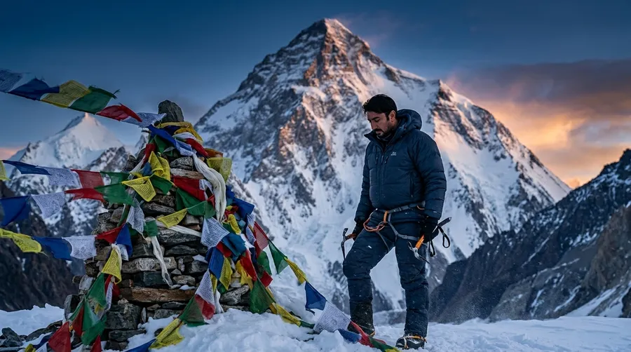
As someone who frequently climbs alongside my wife, Miranjani holds a deeply personal significance. It provided the exact endurance benchmark and mental rhythm we relied upon before executing our couple summit and historic apex campover on Musa ka Musalla, as well as tackling technical high-altitude giants like Falak Sar, Churko Peak, and Spantik.
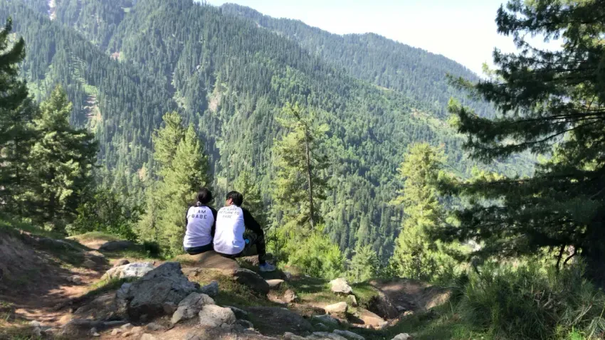
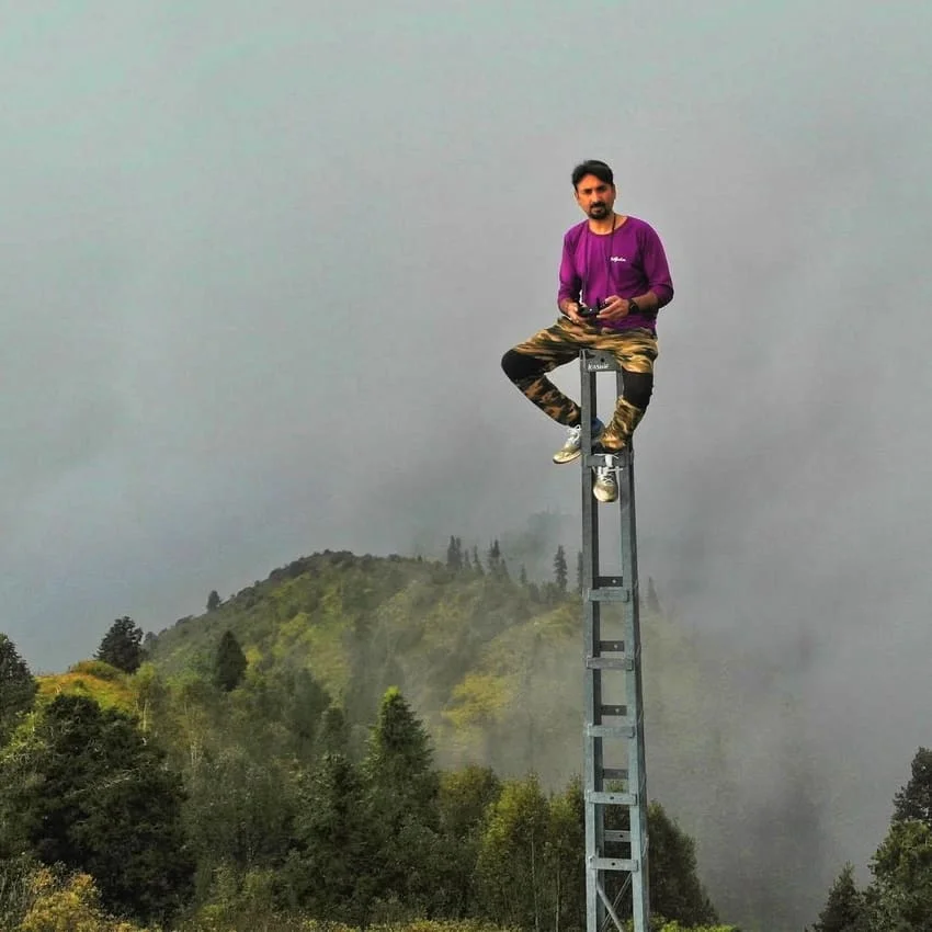
The drone perspective below captures the expansive solitude of our couple summit atop the 2,992-meter crest:
Route Architecture: Visualizing the Nathiagali Ascent
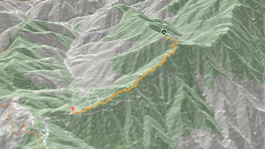
Successfully navigating the Miranjani ascent requires understanding the vertical anatomy of the trail. The route gains approximately 592 meters of direct elevation over 4.5 kilometers of steep trail. Beginning at the Governor House gate in Nathiagali (2,400m), the trail transitions from broad stone paths into a dense forest staircase of exposed tree roots before breaking out onto the wind-scoured sub-alpine ridge at 2,750 meters:
[Nathiagali Trailhead / Forest Gate (2,400m)]
                      │
                      ▼ (+150m / Gentle Warmup Through Lush Pines)
[Mid-Forest Clearing / Rest Outcrop (2,550m)]
                      │
                      ▼ (+200m / Relentless 30° Incline over Tree Roots)
[Upper Treeline / Ridge Shoulder (2,750m)]
                      │
                      ▼ (+242m / Exposed Grassy Ridge & Rock Scrambles)
═════════════════════════════════════════════════════════════════════
[Miranjani Summit Crest & Cairn (2,992m)] ── Apex of the Galyat Range
═════════════════════════════════════════════════════════════════════
The route map below outlines the geographic trajectory through the protected forest reserves of the Ayubia National Park boundary to the summit crest:
The Approach: Navigating Ancient Deodar and Pine Groves
The expedition begins at the historic hill station of Nathiagali. Easily accessible via the Murree-Abbottabad highway, the trailhead sits quietly behind the colonial-era Governor House and Forest Rest House at 2,400 meters.
Setting out into the crisp mountain air, the senses are immediately enveloped by the rich perfume of damp earth, crushed needles, and towering blue pine (Pinus wallichiana) and deodar cedar (Cedrus deodara). The opening 1.5-kilometer section follows a forgiving, gentle incline along packed stone trails. This initial corridor is crucial: in endurance mountaineering, your warm-up sets the aerobic tone for the entire ascent. Rushing this first half-hour causes premature lactic acid accumulation in your calves and leaves you gasping as the angle of ascent steepens.
While casual tourists and local walkers often populate the initial kilometer, the crowd rapidly disappears once the trail enters the deeper canopy past 2,550 meters. The chatter fades, replaced by the whispering wind through ancient boughs and the rhythmic sound of your boots biting into the loam.
The Cardiovascular Crucible: Steep Incline and Exposed Roots
Beyond the mid-way forest clearing, the gentle forest walk ends abruptly. The trail angles sharply upward into a sustained 30-to-35-degree slope that does not relent until you break the treeline.
This is the true crux of the Miranjani trek. Decades of heavy foot traffic and monsoon rainfall have stripped away topsoil, leaving behind a complex, natural staircase of slick, intertwined tree roots and loose limestone rubble. Every upward step requires conscious foot placement and ankle stabilization. If it has rained recently, the red mountain clay turns into treacherous mud, turning an already demanding cardiovascular climb into an energy-sapping test of balance.
At an elevation approaching 2,800 meters, atmospheric pressure drops, and each breath delivers noticeably less oxygen than at sea level. Your heart rate settles into high aerobic zones. Here, alpine discipline takes precedence: maintaining a rhythmic, synchronized breathing cadence, engaging your core, and using trekking poles to offload 20% of the vertical impact from your quadriceps and knees.
The Summit Ridge: Breaking the Treeline into the Alpine Fog
After nearly two hours of continuous upward labor through the forest canopy, the dense canopy suddenly thins out. You step through the final cluster of stunted birch and juniper shrubs and emerge onto the wind-exposed summit ridge at 2,750 meters.
The transition is exhilarating. The sheltered humidity of the forest vanishes, replaced by a biting mountain breeze that drops temperatures rapidly to 8°C or lower. The trail narrows to a well-defined ridgeline spine winding across high alpine meadows. In spring and early summer, these open slopes erupt in a vibrant carpet of wildflowers; in late autumn, they turn golden under a pale northern sun.
Weather on the Miranjani ridge is fiercely dynamic. Within minutes, thick white fog can sweep upward from the Jhelum Valley below, completely enveloping the ridge in mystical whiteout conditions. Navigating this exposed final 800-meter horizontal traverse requires steady footing over occasional rocky scrambles and total situational awareness.
Standing at 2,992 Meters: Views Across the Greater Ranges
After three hours of sustained cardiovascular effort and 592 meters of direct vertical climb, the ridge culminates in the stony summit mound of Miranjani Peak at exactly 2,992 meters.
Standing beside the summit stone monument alongside your climbing partner brings an intense sense of shared triumph. The panorama from this vantage point is nothing short of breathtaking. To the south and west, the rolling emerald ridges of Galyat and the haze of the Punjab plains unfold into the horizon. To the east, the deep canyon of the Jhelum River cuts through the mountains of Azad Kashmir.
On crisp, cloudless mornings—particularly following an autumn rain—the northern horizon reveals the ultimate reward: the colossal, ice-clad pyramid of Nanga Parbat (8,126m) gleaming more than 130 kilometers away in the Great Himalayan Range. Standing at sub-3,000 meters while gazing upon an 8,000-meter death-zone titan creates a powerful, humbling connection across the alpine topography of Pakistan.
Couple Alpine Dynamics: Mutual Pacing and High-Altitude Sync
Climbing as a couple demands an entirely different psychological playbook than solo alpinism or commercial group trekking. On a steep, oxygen-depleting trail like Miranjani, the speed of the ascent is dictated not by the faster partner, but by the shared rhythm of the team.
Throughout our ascent, my wife and I practiced structured pacing protocols:
- Lead Alternation: Taking turns setting the pace every 30 minutes prevents unilateral fatigue and maintains mutual mental engagement.
- Synchronized Breathing: Matching footsteps to a steady two-count breath prevents sudden anaerobic spikes and keeps heart rates in sustainable fat-burning zones.
- Gear Load Balancing: Ensuring both climbers carry balanced daypacks with water, warm layers, and emergency medical kits reinforces mutual self-sufficiency.
Sharing the physical hardship of a steep mountain grind strips away everyday distractions, creating an unbreakable bond of trust and shared resilience that deepens every step toward the apex.
Stepping Stone to the Greater Ranges: Conditioning Playbook
Miranjani must not be treated as a casual tourist attraction; it is the premier high-altitude conditioning laboratory in the Hazara Division. To maximize its training value for greater objectives across the Karakoram or Himalayas, we employ a progressive training protocol:
- Rucksack Loading: Hike the route carrying a 25-to-30-pound pack to simulate high-camp gear loads.
- Double-Ridge Linkup: For elite endurance, link Miranjani with the adjacent Mukshpuri Peak (2,800m) via the connecting Dunga Gali forest traverse, completing over 16 kilometers and +1,100 meters of cumulative ascent in a single push.
- Pacing Time Trials: Monitor your ascent time from trailhead to summit. Pushing your ascent time below 2 hours while maintaining aerobic nasal breathing signifies excellent high-altitude base fitness.
Are you planning a high-altitude trek or looking to build progressive endurance for Pakistan’s peaks? Connect with Goher K to discuss route strategies, acclimatization protocols, and mountain preparation. Explore more firsthand chronicles in Mountaineering Expeditions.
Miranjani Expedition Strategy Ledger and Fact File
The operational parameters below outline the critical geographical, navigational, and tactical markers for planning a self-sufficient ascent of Miranjani Peak:
| Operational Metric | Strategic Expedition Parameter |
|---|---|
| Mountain Apex | Miranjani Peak (Crown of the Galyat) |
| Official Summit Altitude | 2,992 meters (9,816 feet) |
| Trailhead Location | Nathiagali Governor House Gate (2,400m) |
| Direct Elevation Gain | +592 meters continuous vertical incline |
| One-Way Trail Distance | 4.5 kilometers (9.0 km total round-trip) |
| Ascent Timeline | 2.5 to 3.5 hours at moderate steady pace |
| Descent Timeline | 1.5 to 2.0 hours (Requires trekking poles for knee protection) |
| Water Availability | Zero water sources above the 2,550m forest mark; carry 2.5L minimum |
| Required Equipment | Ankle-high hiking boots, trekking poles, windproof hardshell, headlamp |
| Prime Climbing Seasons | May to June (Wildflowers) & September to November (Clear skies) |
Frequently Asked Questions About Miranjani Trek
What is the elevation of the summit of Miranjani?
The summit of Miranjani stands at an elevation of 2,992 meters (9,816 feet) above sea level. It is the highest geographic point in the Abbottabad District and the entire Galyat mountain system.
Where does the Miranjani trek start, and how do you reach it?
The trek begins behind the Governor House and Forest Rest House in Nathiagali at approximately 2,400 meters. Nathiagali is easily reached via a 2.5-hour paved road drive from Islamabad or Abbottabad along the Murree-Nathiagali route.
How difficult is the Miranjani trek for beginners?
While it involves zero technical rock climbing or roped glacier travel, it is a demanding Grade I endurance trek. The trail climbs 592 vertical meters continuously over steep, root-covered terrain at a 30-degree incline, requiring good cardiovascular stamina.
Can you see Nanga Parbat from the summit of Miranjani?
Yes. On exceptionally clear mornings—particularly in autumn or early spring after rain clears the atmospheric haze—the snow-covered 8,126-meter summit pyramid of Nanga Parbat is clearly visible on the northern horizon, over 130 km away.
How long does it take to complete the round-trip trek?
The round-trip distance is 9.0 kilometers. Most hikers take 2.5 to 3.5 hours for the ascent and 1.5 to 2.0 hours for the descent. Including summit rest and photography, plan for a total excursion time of 5 to 6 hours.
What is the best season to hike Miranjani Peak?
The optimal hiking seasons are spring (May to June) for mild temperatures and lush flora, and autumn (September to November) for crystal-clear panoramic visibility. Winter hikes (December to March) require microspikes and gaiters due to deep ridge snow.
Are there water sources available along the trail?
No reliable natural drinking water sources exist above the mid-forest mark (2,550m). Hikers must carry at least 2 to 2.5 liters of water per person, along with electrolytes, before departing the Nathiagali trailhead.
Is it safe to hike Miranjani as a couple or independent team?
Yes, Miranjani is very safe and popular for couples and independent groups. The trail is well-trodden and distinct. Key safety measures include starting early in the morning, carrying rain jackets for unexpected mountain fog, and wearing boots with solid traction.